What is a hydrographic survey?
Case study #1 – Lake water hydrology and bathymetry
Hydrography deals with the measurement and description of underwater features such as depth, tides, currents and bottom profiles. Bathymetric surveys are a specific subset of this which deals with the mapping of the underlying bed. Hydrographic surveys are used for a variety of activities, such as construction, port and harbour maintenance, dredging and coastal engineering and management.
Bathymetric surveys
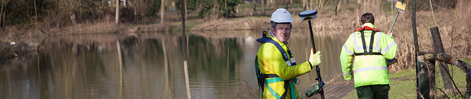
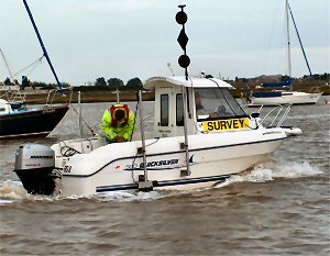
Randall Surveys undertakes hydrographic surveys, inshore, lake, reservoir and river surveys, canal surveys and waterway surveys throughout the UK and Europe. Our fully equipped hydrographic teams operate a fleet of vessels equipped with the latest multibeam, sector scan and single beam echo sounders, on-board processing and data displays, real-time centimetre level GPS position fixing, currentmetering, sidescan sonar and magnetometers. We have MCA Cat 4 vessels and qualified crews enabling us to offer bespoke proposals for any survey requirement on inland and coastal waters anywhere within the UK or Europe.
Our trailer-launched craft can be deployed almost anywhere and we specialise in undertaking surveys of the following:
- Rivers, estuaries and harbours
- Lakes and reservoirs
- Canals and inland waterways
- Beaches and coastlines
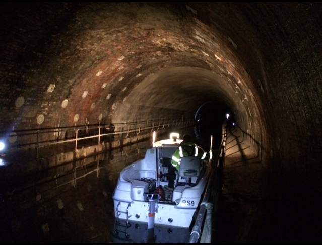
- Tunnels!
Multibeam echo sounder surveys
The latest addition to our equipment pool is an Odom MB2 multibeam echo sounder. This is a high quality sounder specifically designed to operate in shallow waters such as lakes, rivers and harbours. When combined with our motion reference unit, heading sensor and radio and VRS capable RTK GPS receivers we can produce stunningly detailed and accurate portrayals of the underwater topography with resolutions of just a few centimetres.
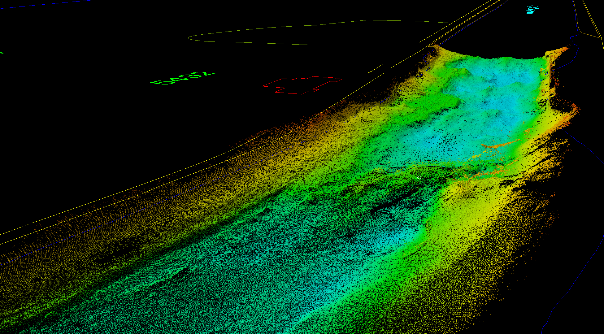
Uneven riverbed with submerged trees
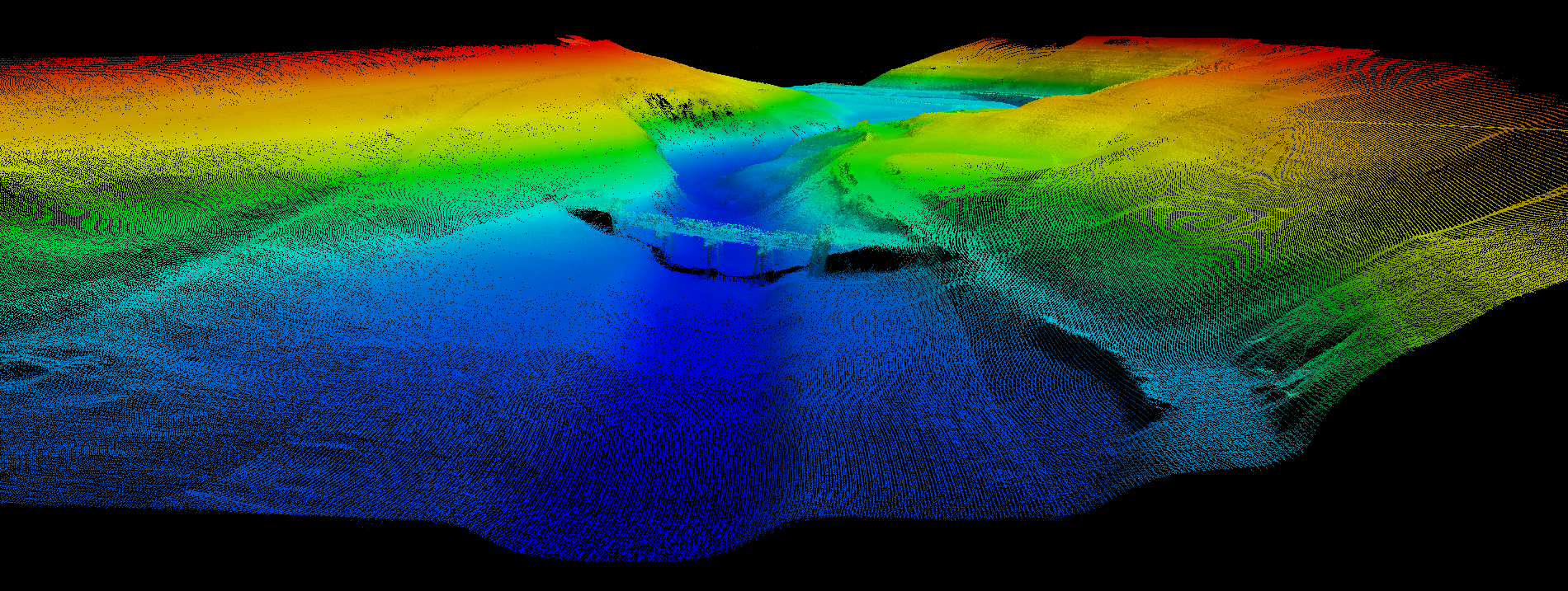
Flooded valley with pipe bridge
Hydrographic Surveys
Randall Surveys have carried out:
- Current metering for power station outfalls
- Warm-water plume monitoring from industrial plants
- Flow metering of small rivers for flood prevention studies
- Magnetometer surveys to detect buried underwater sewage outfall pipes
- Water column temperature monitoring
Our hydrographic surveys integrate fully with our topographic surveys, making Randall Surveys the ideal choice for shallow water and water’s edge environments as well as deeper water and tidal areas.
If you would like to view some examples of bathymetric surveys please click the following images:


If you would like to discuss a hydrographic survey please call us on 01787 227580 or email us at enquiries@randallsurveys.co.uk.
 Follow us on Twitter
 Like us on Facebook