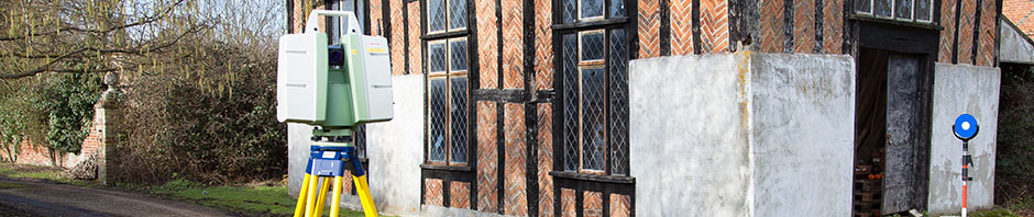
Randall Surveys undertakes a range of measured building surveys on structures of all sizes, from single storey one-room pump houses to ten storey flats or offices, or even cathedrals! These surveys are often combined with our GPS and Land Survey expertise to provide a complete one-stop service.
Our survey crews are equipped with modern data capture equipment and undertake building surveys throughout the UK in a wide variety of environments and for many different purposes. Our drawings are typically used as part of a redevelopment or refurbishment project, or as plans for building maintenance and archive records. Typical building survey outputs are:
- Floor plans, cross sections and elevations
- 3D wireframe models
- Point cloud data
- Rectified imagery
- Roof plans
- Rights of light drawings
- Verticality studies
All our surveys are drafted electronically on CAD (Computer Aided Design software) and all data is available in both digital and printed format.
Building Information Modelling (BIM)
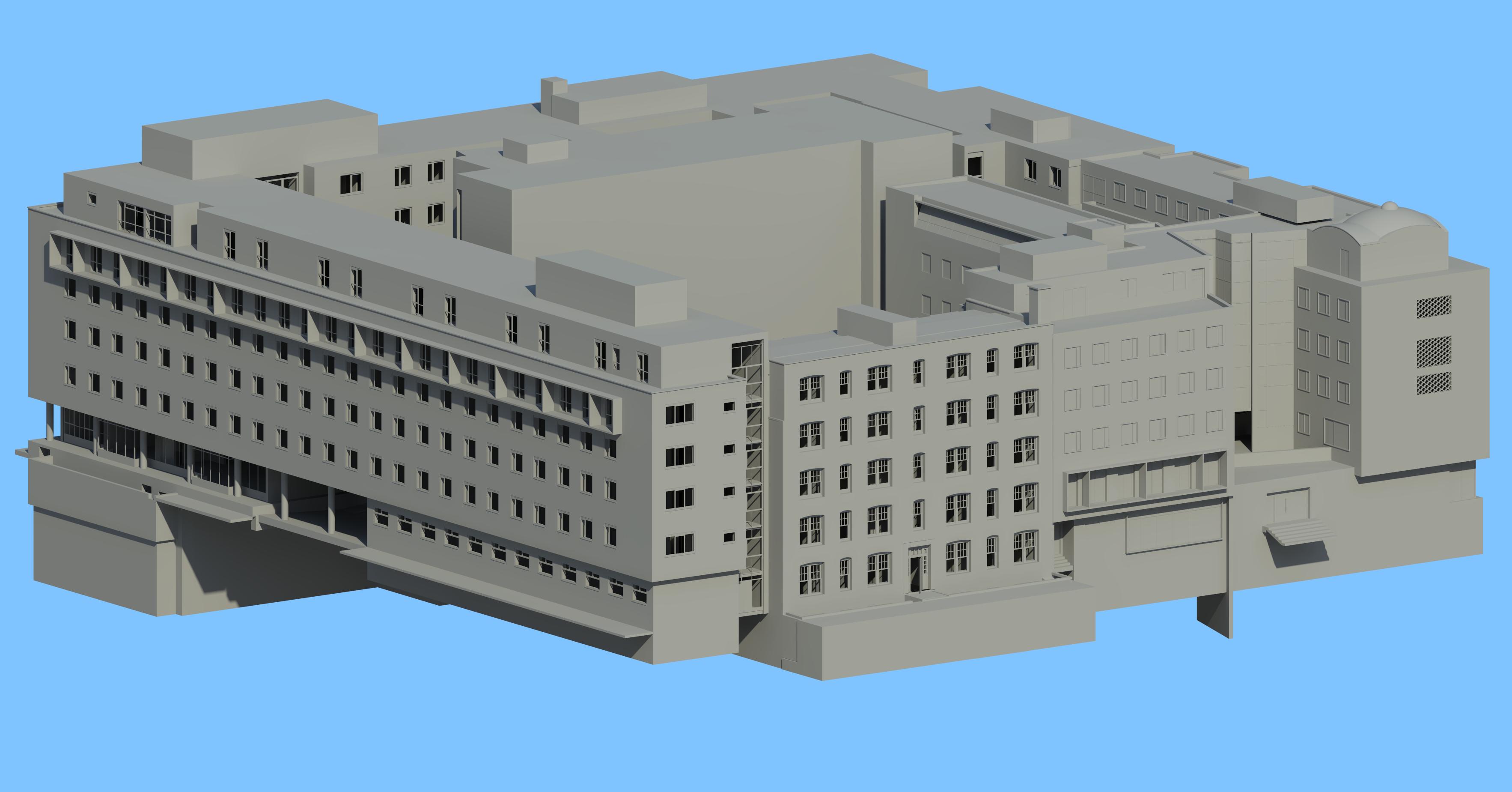
Solid model of large measured building survey, rendered in AutoDESK Revit, click for HiRes version
Much as computer aided design (CAD) has replaced the drawing board, building information modelling is a new way of approaching the design and documentation of building projects. A building information model is a complete 3D model that contains more than basic architectural information; it includes engineering information and operational information too. This enables more accurate planning of design and through-life building management.
Contact us for a fixed price quotation on 01787 227580 or email at enquiries@randallsurveys.co.uk
 Follow us on Twitter
 Like us on Facebook