3D Laser scanning, whilst relatively new, is quickly becoming the new industry standard as a way to make very fast and very accurate measurements in complicated environments. Laser scanning increases the speed and accuracy in the creation of plans, elevations and profiles. Accurate volumes and area calculations can be determined from the detailed and accurate 3D geometry created from the point clouds.
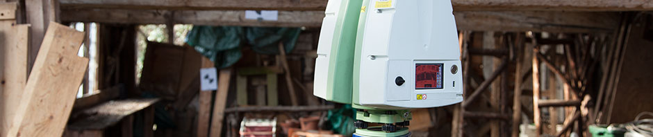
Sometimes called High Definition Surveying (HDS), the laser scanning equipment creates a 3-dimensional “cloud” made up of millions of dimensionally accurate data points. These are collected in a matter of minutes, and are then used to create a complete and detailed 3D model. These models are then used to create 2D drawings, elevation, sections, rectified photographs and final survey documents.
As a laser scanner is a ‘remote’ instrument, it can be ideal for surveying hazardous areas safely from a distance, which may even be a road busy with traffic or the underside of a bridge. Because a laser scan is so detailed, it often eliminates the need for future site visits.
Laser scanning is often used in architecture, engineering and construction, and many other capital projects where detailed design reviews are required, in particular major retrofit projects, where accurate “as-built” models of existing structures allow for more accurate design and construction planning.
If you would like to discuss a project please call us now on 01787 227580 or email us at enquiries@RandallSurveys.co.uk
 Follow us on Twitter
 Like us on Facebook