
Topographic land surveys are used to identify and map ground contours and features such as trees, buildings, streets, walkways, utilities, walls and perimeter boundary lines. They are most commonly commissioned by architects, developers, local authorities and landowners who require dimensionally accurate drawings (or topographic maps) for a given area of land.
Randall Surveys will undertake projects, ranging from a single building plot to green and brown field development sites. Our skilled survey teams are equipped with the latest surveying equipment and are dedicated to providing accurate, high quality data, and a first class presentation of results.
GPS Surveys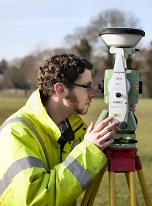
A GPS Survey is a fast and reliable means to accurately collect data. It improves the accuracy of land surveys, and is ideal for creating accurate control points for setting out of construction sites. Randall Surveys utilises the latest GPS instruments and post-processing software and can carry out all aspect of GPS surveying for accurate mapping and setting out.
Setting out
Setting Out typically refers to the marking out of a new construction site or civil engineering project, where the design starts to become reality! Positional accuracy is critical from the outset, and our experienced teams manage high-accuracy placement of infrastructure and buildings on a regular basis.
If you would like to discuss a topographic survey, GPS Survey or a setting out project please call us on 01787.227580 or email us at enquiries@randallsurveys.co.uk.
 Follow us on Twitter
 Like us on Facebook