For many civil engineering and construction projects, particularly on brownfield sites, detailed CAD drawings of underground services, based on accurate land/topographic survey information, are essential at the design stage to use or avoid existing buried services, drainage networks and other potential obstructions, and for effective planning of new services.
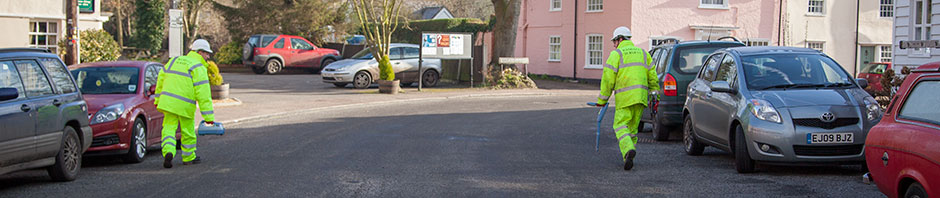
This is typically achieved by undertaking a detailed underground services location survey of the site using Electromagnetic Detection (EM) and Ground Penetrating Radar techniques (GPR). (For best results these two are used together.) The information obtained from underground services location surveys is almost always added to a topographic survey of the site which may have previously been completed or can be undertaken at the same time although a “mark out” service is also provided on occasions. In this instance, the routes of services are identified and marked on the ground at the time of survey but no plan is produced thereafter.
Electromagnetic detection surveys
Randall Surveys undertakes electromagnetic detection surveys using Radiodetection RD4000 and RD8000 detection units, in either passive or active mode (i.e. by either detecting the signal that the service is providing itself or by inducing a signal onto the service and then detecting it elsewhere thereby determining its route, location and indicative depth).
Ground Penetrating Radar surveys
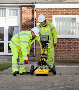
By their very nature, electromagnetic techniques cannot normally detect non-metallic pipes. Ground Penetrating Radar is used for this purpose and works by emitting radar signals into the ground and detecting anomalies in the return signals. Careful interpretation of this data allows for the accurate determination of buried services. Randall Surveys uses both Mala and IDS radar units to guarantee the best solution in different situations. As with EM techniques, GPR can also provide an indication of depth.
Randall Surveys has, over the past twenty years, undertaken numerous underground services location surveys, ranging from tiny parcels of greenfield land and basements to vast sewage treatment works and complex brownfield sites. We provide comprehensive and highly accurate data, thereby reducing the financial and safety risks associated with the development of such sites.
Underground services location surveys are normally undertaken to locate such services as:
- Electricity cables
- Gas mains and pipes
- Water mains and pipes
- Foul, combined and surface water gravity sewers
- Pumping mains
- Telecommunications cables
- Cable TV cables
- Data cables
- Oil pipelines
- Fuel lines
Presentation normally includes the route and indicative depth of the service often shown in its own layer in the CAD drawing.
In respect of gravity sewers it is normal to show cover and all invert levels, pipe sizes (and material where evident), connectivity and direction of flow. CCTV surveys of sewers can also be undertaken to confirm routes, profile, pipe condition and any lateral connections and junctions as well as identifying contamination, root intrusion, ponding and misshapen pipework.
If you would like to discuss an underground survey project, please call us on 01787 227580 or email us at enquiries@randallsurveys.co.uk.
 Follow us on Twitter
 Like us on Facebook