Utilities surveying and mapping is carried out as a means of producing detailed plans showing the layout of buried apparatus and assets. It is often undertaken in the public domain and can comprise a desktop exercise, field survey or a combination of both.
Desktop Study
This normally comprises the acquisition of statutory authorities asset plans and records and the compilation of a comprehensive plan showing all the information available on one drawing. The utilities details are often overlaid onto OS MasterMap but on occasions a topographic survey is also undertaken at the same time and used as a basis for the portrayal of the utilities routes.
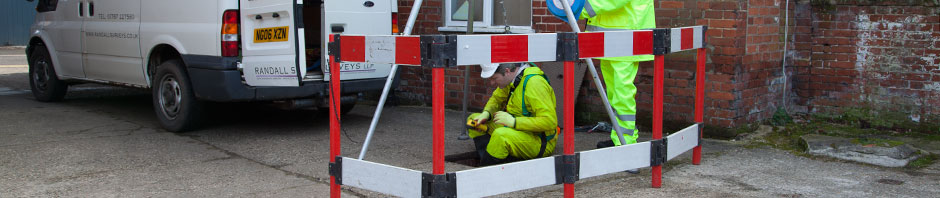
Utilities survey
The routes and depths of buried pipes and cab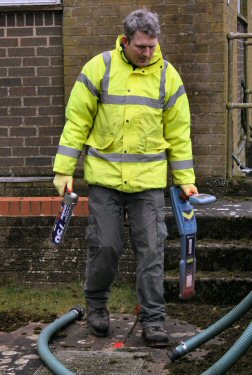 les will be traced using either electromagnetic and/or ground penetrating radar techniques and their precise position will be determined using GPS measurements. The information is then added to OS mapping or a topographic survey drawing if one exists. It is normal for the statutory authorities record plans to be obtained in advance of this exercise to ensure best coverage and completeness of survey information on conclusion.
Randall Surveys are specialists in both the procurement of stats records and plans and the compilation of comprehensive drawings as well as the surveying of both underground and above ground utilities. Our survey teams are equipped with the latest detection technology to locate buried apparatus including electromagnetic (EM) using RD 4000s and RD 8000s, Ground Penetrating Radar (GPR) and also CCTV surveys.
We undertake utilities mapping of localised areas for borehole location to long lengths of highway in both urban and rural environments for pipe and/or cable laying, ensuring accurate data collection and analysis, whatever the size of the task.
If you would like to discuss a project please call us now on 01787 227580 or email us at enquiries@RandallSurveys.co.uk
 Follow us on Twitter
 Like us on Facebook