
In 2014 Randall Surveys LLP were asked to put together a survey package for a lake in the south of England. Our client, a multinational consultancy, had been tasked with investigating the bathymetry of the lake as well as the properties of the water and it’s immediate environment. We put together a plan to survey the lake bed and to monitor the water and environment for a period of six months. A monitoring regimen was designed in collaboration with the clients which would monitor 12 parameters at two points within the lake and to measure and monitor the water temperature at an additional location.
Our first task was to survey the lake bed using dual sector scan echo sounders. We used RS9, the smallest of our boats which are specially equipped for this task, due to it’s ease of trailer launching without a slipway or lifting facilities on site. You can click on any of the images below for larger versions:
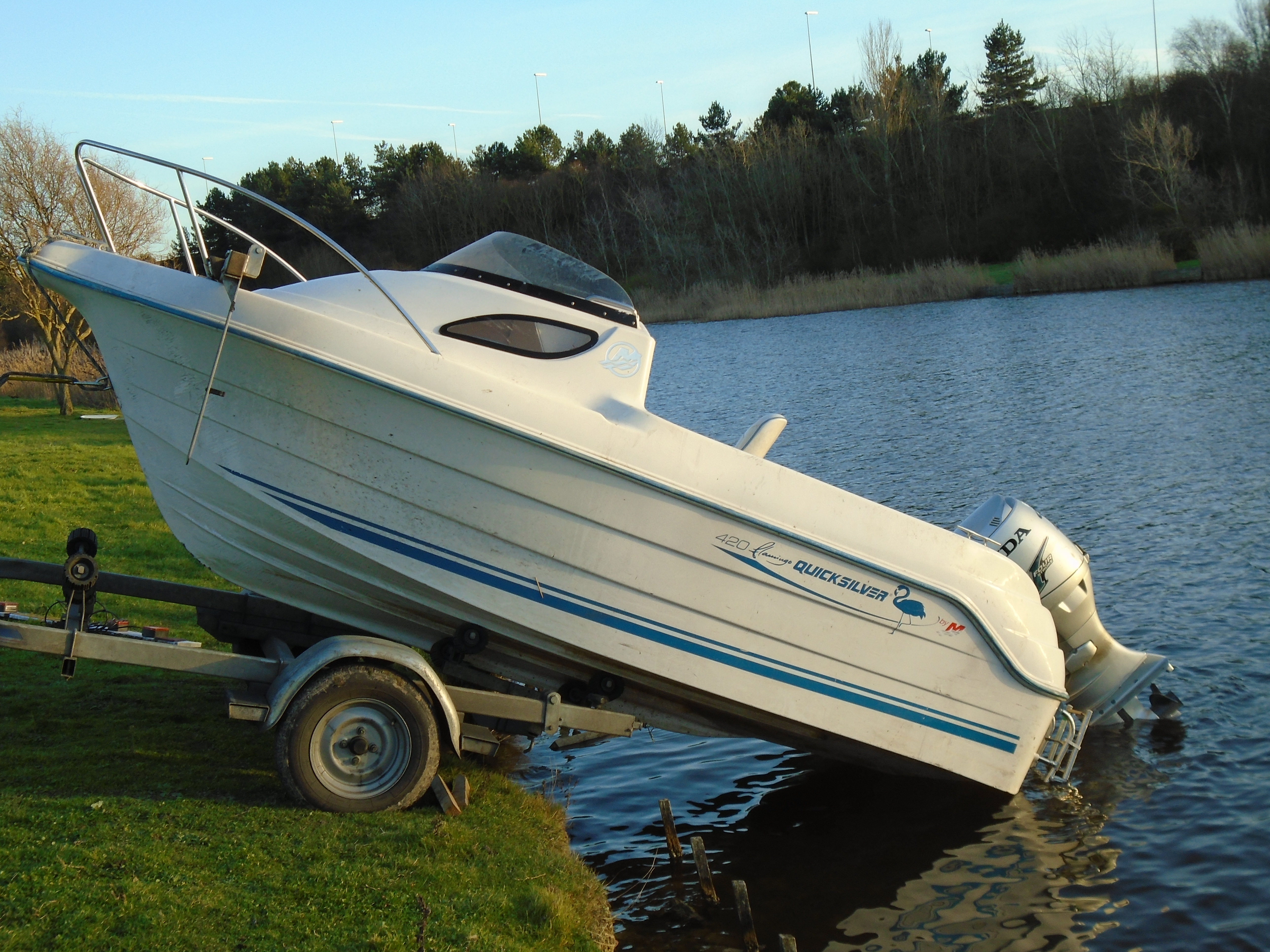
Trailer launching RS9
Over a period of two days we mapped the lake bed intensively to produce a full three dimensional model which we created in the flagship civil engineering CAD and modelling package AutoCAD Civil3D. This model was then subsequently used to extract a coloured contour plot, cross sections and the volume of water in the lake.
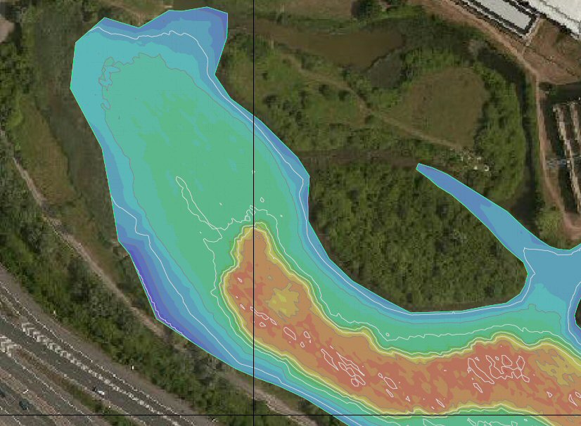
Lake bathymetry
The bathymetric survey was used to decide the location of our primary vertical monitoring profile point, with one of the deepest parts of the lake being chosen. The water depth was 5.5m and a string of thermistors were deployed at 1m vertical intervals attached to a buoyed and weighted chain. Most importantly, in addition to the thermistors we installed two YSI EXO2 multi-parameter sondes which would log temperature, dissolved oxygen, pH, salinity, conductivity and turbidity at 30 minute intervals throughout the monitoring period.
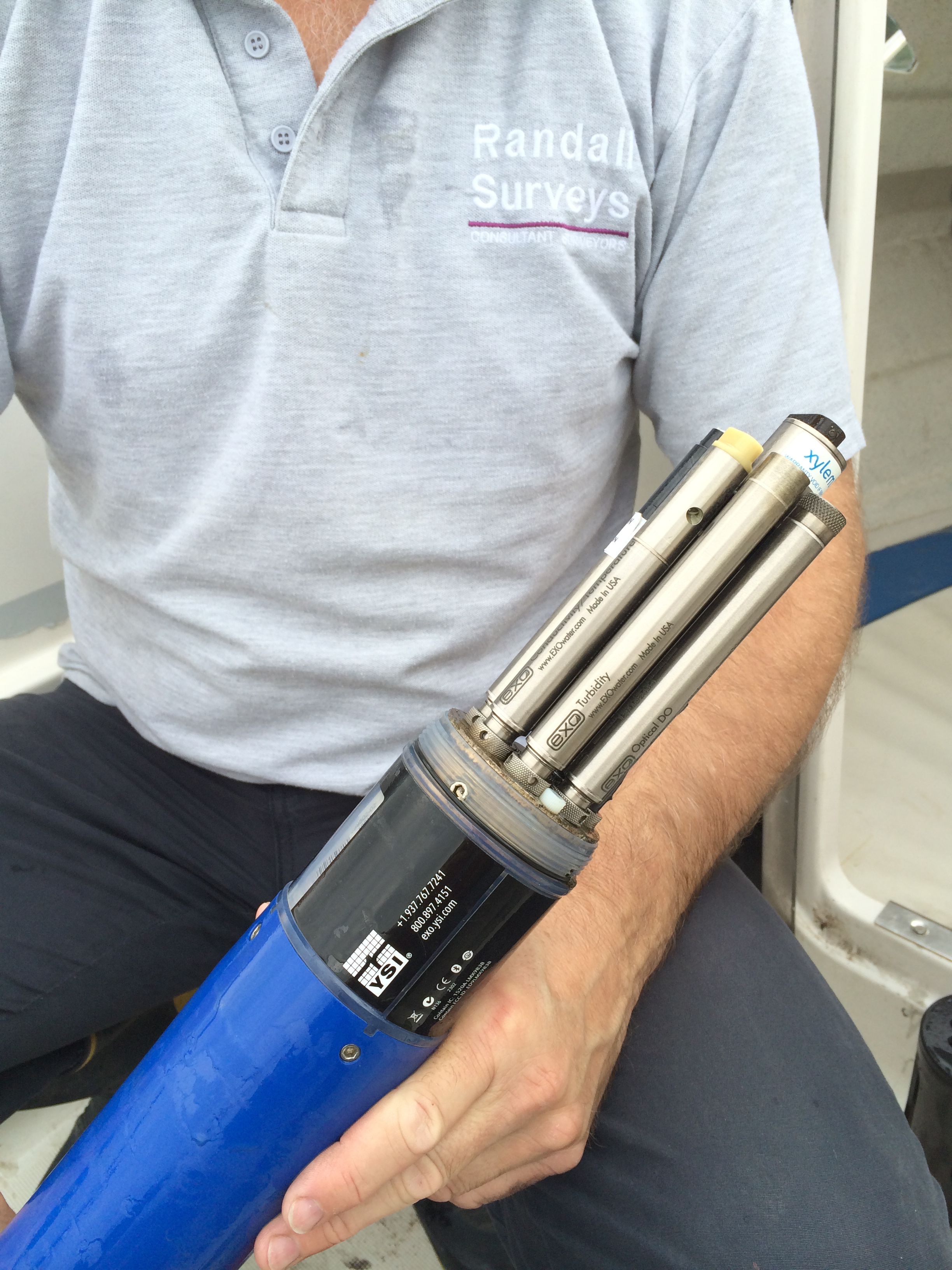
One of the YSI EXO2 sondes being readied for deployment
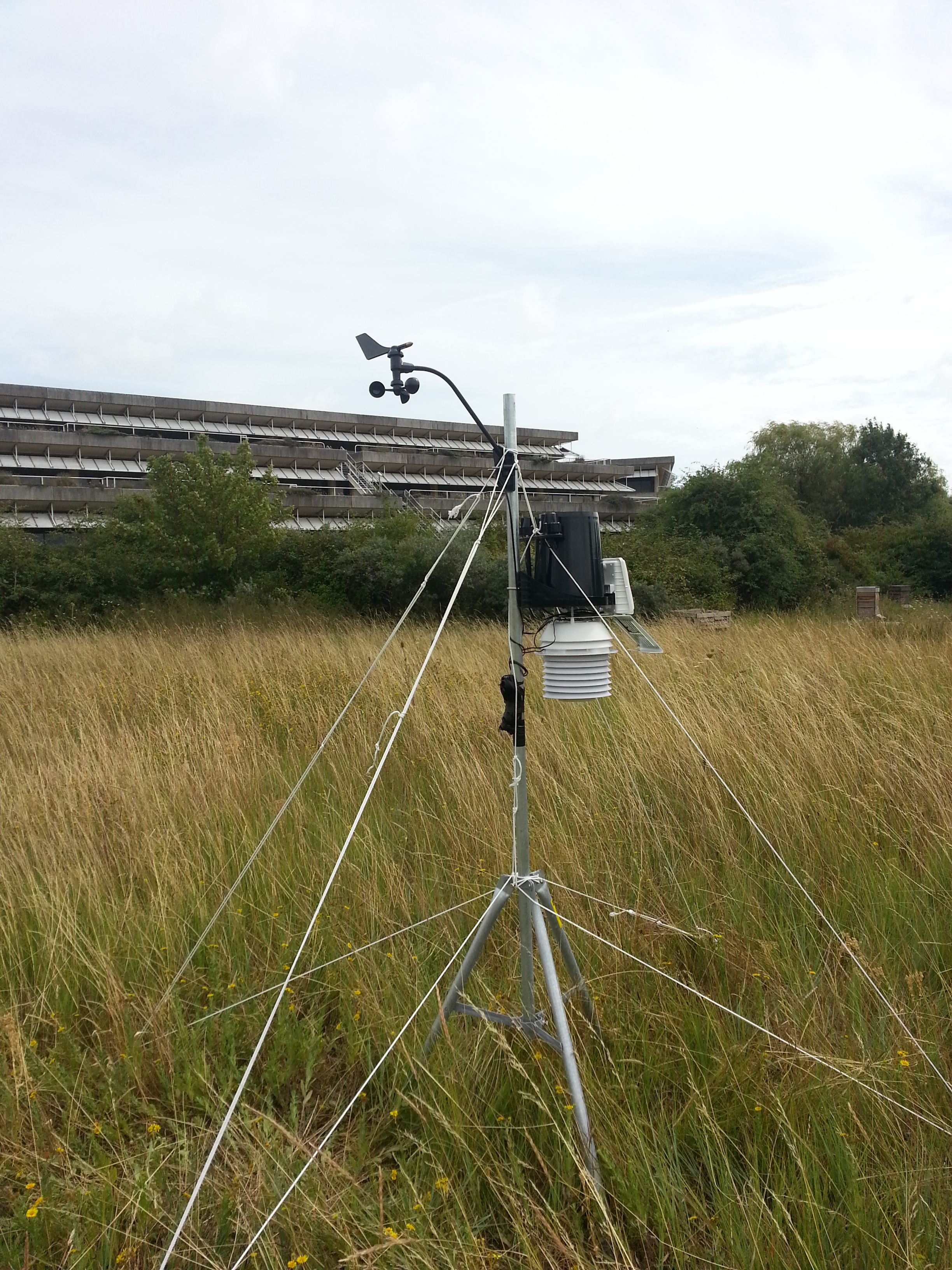
A weather station was set up on site to log wind speed/direction, rainfall totals/rate, temperature, atmospheric pressure, solar radiation and UV index.
A surface temperature survey was then carried out over the whole of the lake area and the monitoring phase of the project began. Over the next six months three visits were made to site to download interim weather and water quality data and to carry out further snapshot surface temperature surveys. During these visits we took the opportunity to calibrate and check the sondes and to replace batteries and examine the installation for signs of wear or tampering. As a result of the interim visits a modification to the original scope was agreed whereby we added twenty vertical profile points spread over the lake area. At each of these locations all the hydrology parameters were measured through the water column to help identify stratification. At the end of the six months the equipment was all removed from site with no visible signs left from our survey operations.
The water quality data was extracted and compiled into spreadsheet form for ease of use of the client. The results were surprising and were of great use for the client in determining the next step in their plans for utilising the lake; amongst the surprises were the presence of a hitherto unsuspected and extremely well defined halocline.
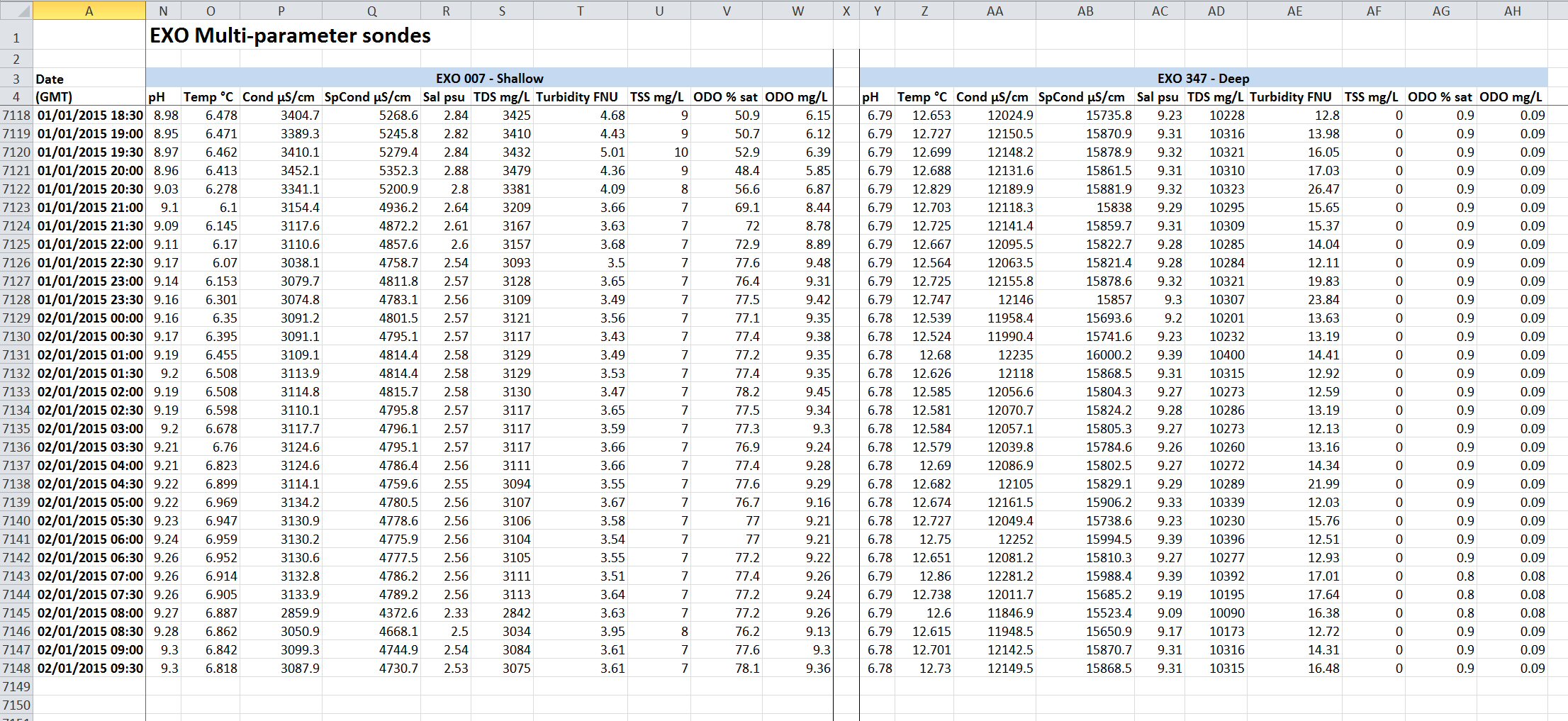
Hydrology data
This was a successful project which overcame a number of difficulties that cropped up during the monitoring interval. A particular consideration for future similar prjects will be to utilise live-streaming hydrology data allowing the client and ourselves to monitor the hydrology parameters in real-time over a browser interface. For further details of any of the above or to discuss a similar project please contact us.
 Follow us on Twitter
 Like us on Facebook